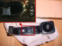
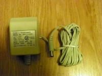
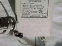
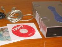
This is used, still in working condition.
Built on Microsoft MapPoint business mapping technology, Streets & Trips 2006 features detailed street-level maps, unique routing and searching, and accurate turn-by-turn driving directions.
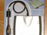
Microsoft Streets & Trips 2006 with GPS Locator combines a sleek and stylish Global Positioning System (GPS) receiver with Streets & Trips, a complete and customizable trip-planning software package. With new voice-prompted driving directions and other advanced GPS features, you will always know exactly where you are and where your next turn is. Plus, you get more trip-planning features than on online mapping sites, so you can plan a unique trip based on your specific preferences. GPS hardware comes USB ready to turn your laptop into a real GPS device - just plug it in and go!
http://www.nothingbutsoftware.com/window.asp?ProductCode=79608
Full Integrated GPS Receiver and Software
Easily expands for use with your Bluetooth-enabled Pocket PC or Smartphone. (Expansion options sold separately)
GPS requires no subscription.
Tracks up to 12 satellites simultaneously for superior performance and fast signal acquisition.
Comes USB ready - plug the GPS Locator receiver into a laptop running Streets & Trips 2006 and it automatically synchronizes for instant real-time GPS tracking.
Streets & Trips 2006 features more than 5.9 million miles of streets and highways and 1.8 million points of interest, including:
571,588 Restaurants
273,614 Service Stations
65,506 Grocery Stores
107,096 Banks
84,568 Bars
79,317 Hotels
93,574 Gas Stations
119,718 ATMs
11,553 Art Galleries
11,530 Campgrounds
14,055 Libraries
7,102 Rental Car Agencies
8,478 Golf Courses
9,820 Museums
6,596 Cinemas
107,117 Colleges and Universities
3,878 Theaters
2,925 Airports
1,421 Train and Bus Stations
90,923 Monuments and Attractions
1,186 Wineries
1,966 Rest Areas
Your trip, your way
New! Voice-prompted directions with Windows XP
New! Advanced GPS features
Customizable trip planning and maps
Find hotels, restaurants, and more
Get accurate, detailed directions
Plan trips, and calculate mileage, time, and expenses
All updated maps for the USA and Canada
More features than online mapping sites
Includes Pocket Streets for your Pocket PC and Smartphone *
Trip planning made easy
Get precise turn-by-turn directions virtually anywhere in the United States and Canada.
Plan a trip based on your preferred drive time, speed, and road type.
Plan stops, detours, and fuel stops to make the most of your travel time.
Calculate mileage, travel time, and fuel costs before you start your journey.
Quickly alter your route and add multiple destinations.
Pick a starting point and see places you can travel to within a specified amount of time.
Customize your maps and printouts
Make your maps and printouts more descriptive by adding notes, addresses, and phone numbers for your planned stops.
Highlight details and customize maps with a variety of Pushpin icons or import graphics to create custom Pushpins.
Quickly zoom in to street level and back with Zoom Slider, to get just the right level of detail on your map.
Patented Snap route Technology lets you drag and drop routes to instantly change travel plans.
Always know where you are going and what to expect along the way
Find the best route from updated and complete mapping coverage of the United States and Canada.
Quickly locate restaurants, hotels, ATMs, gas stations, attractions, and other points of interest.
Avoid potential delays by getting road construction updates from the Web.
Import contacts into your maps directly from Microsoft Office Outlook and Excel.
Identify one-way streets at a glance.
Take Streets & Trips with you
Choose from multiple options for printing maps and route details.
Includes Pocket Streets for your Pocket PC or Smartphone for on-the-go access. (Pocket PC or Smartphone not included)
Send maps and itineraries in e-mail, or post them online to share with friends and family.
New! Voice prompting and advanced GPS functionality
You'll always know exactly where you are and where to turn next with the new voice-prompted driving directions and other advanced GPS features, including Night Map Style.
Choose from multiple map views, including Rotate Map and Keep Position Centered options.
New! Dynamic Turn View feature automatically zooms the map to show relevant details based on how close you are to your next turn.
Reroute from Here feature allows you to change or recalculate your route from your current location.
New! Voice- and text-prompted directions always let you know where your next turn is.
Pinpoint your exact location.
GPS Trail feature allows you to see exactly where you have been on the map.
Product images may differ from actual product appearance.
Windows XP Home, Windows XP Professional, Windows Server 2003, Windows Second Edition, Windows Millennium Edition, Windows 2000 Professional or later operating system required
PC with Pentium II or higher processor; Pentium III recommended
Microsoft Internet Explorer 5.5 browser software later, Internet Explorer 6.0 SP1 included (will not displace your primary browser)
For Windows XP Home and Windows XP Professional: 64 MB of RAM (128 MB recommended)
For Windows Server 2003: 256 MB of RAM
For Windows 98 Second Edition: 24 MB of RAM
For Windows Me, 32 MB RAM
For Windows 2000 Professional: 64 MB of RAM 128 MB recommended)
Running additional applications simultaneously may require additional memory
Available hard-disk space: 1.1 GB for full installation or 500 MB for minimum installation. Some users may require up to an extra 100MB for System Files Update (hard disk usage will vary depending on configuration).
4x speed or faster CD-ROM drive
Super VGA (800 x 600) or higher resolution monitor with 256 colors; a monitor with higher resolution and more colors recommended and required for Driving Guidance feature
Microsoft Mouse, Microsoft IntelliMouse, compatible pointing device
* Pocket PC and Smartphone are not included
Additional items or services requires use certain features:
For Voice Output: Windows XP or higher and compatible soundcard
Microsoft Exchange, Internet SMTP/POP3, IMAP4, MAPI-compliant messaging software required to use Send To as attachment; Microsoft Outlook 2000 or later required to use Send To as picture
14,400-baud or higher recommended
Some Internet functionality may require Internet access and payment of a separate fee to an Internet service provider and local charges may apply
GPS functionality requires a GPS device that supports NMEA 2.0 or later
A free COM port below 20 required for GPS
Pocket Streets:
A Pocket PC running Microsoft Windows CE 3.0 or later with ActiveSync 3.7 API and 500KB available program memory required for installation of Pocket Streets. Installing map files requires additional memory, approximately 1MB per city map
A Microsoft Windows powered Smartphone 2002 Or Microsoft Windows Mobile 2003 Smartphone or later with ActiveSync 3.7 API and 350KB available program memory required for installation
Payment Methods


Shipping
$5.00
Please Login or Register first before asking a question.


